

These photos brought back memories. We hiked around Lake Louise several years back, to a little teahouse up near Victoria Glacier. The glacier has pulled back considerably over the last few decades as global temperatures rise, and it’s now much smaller than I remember. The trail to the teahouse lies along the path of the retreating ice flow and is filled with stone and sediment, called moraine, that glaciers create as they grind along. Thinking about Lake Louise got me wondering about other famous lakes, a few of which we’ve visited.
Most natural lakes occur in the Northern Hemisphere, which makes sense since that’s where most of the land exists. That’s also where most of the glaciations have occurred over the last few million years, with the last peak ice cover (Last Glacial Maximum) coming about 31,000 to 16,000 years ago. As ice sheets grew and advanced through mountain valleys, they gouged basins in the surface. Often the moraine pushed by the ice created dams that blocked the water when the ice melted. Lake Louise emerged after Victoria Glacier formed a blockage at the end of the valley and melted. The features’ names reflect the maternal relationship: Princess Louise was daughter to Victoria, Queen of England from 1837-1901.

Lake Garda, the largest lake in Italy, lies tucked among the Dolomite Mountains (part of the Alps). When we saw it a few years back, I assumed glaciers figured in its creation as they had in the case of Lake Louise. That turned out to be true, but Lake Garda formed slightly differently. With Louise, the glacier remained in the valley. Garda formed from a “piedmont” glacier, which happens when ice flows beyond its confines onto nearby flat land. The word “piedmont” derives from the Old Italian pie di mont meaning “foot of the mountains.”

Lakes form from geologic processes other than glaciation. Tectonic lakes develop from shifts in sections of the Earth’s crust. The biggest lakes formed this way. Lake Baikal in Siberia is a tectonic lake and the largest freshwater lake in the world. Baikal sits in an active rift valley, where the tear in the crust that created the lake continues to spread by almost an inch a year.
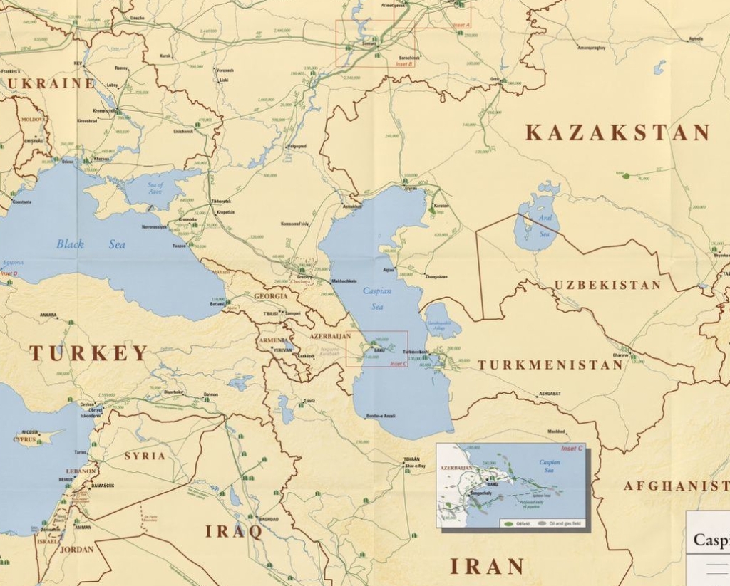
The Caspian Sea, considered the world’s largest lake, also formed through crustal movements. About five million years ago, a seismic event struck the Paratethys Sea, an Oligocene-epoch body of water formed about 34 million years ago. Uplift of the ocean floor split the shallow Paratethys. One of the severed parts became the Caspian.
Lake Tanganyika in equatorial Africa, like Baikal, occupies a tectonic rift valley. Over 400 miles in length, Tanganyika is the world’s longest freshwater lake. Only Baikal beats it in volume, depth, and age.
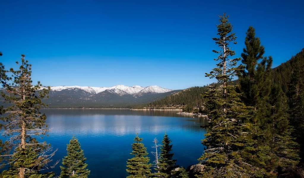
Yet another tectonic lake is Lake Tahoe in the United States. When we saw Tahoe a few years back, I knew nothing of its violent past. Vertical shifting along three fault lines raised surrounding mountains and dropped the basin that Lake Tahoe now occupies. The last earthquake to affect the area occurred four to five thousand years ago. Rainfall and groundwater runoff filled the lake.
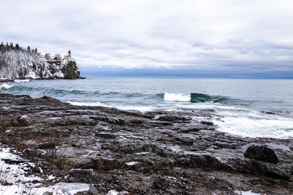
I remember well exploring the North Shore of Lake Superior almost two decades ago. Along with the other Great Lakes, it formed from both tectonic and glacial processes. More than a billion years ago, the crust split open along a junction of two tectonic plates, creating a rift that subsequently filled with softer sediments. A second rift opened 570 million years ago further to the east. Between 95,000 and 20,000 years ago, the Laurentide Ice Sheet blanketed these areas and much of northern North America. The glaciation, a mile thick in spots, carved the lakes from the softer soils left behind in the rifts–Lakes Superior, Michigan, and Huron in the west; Lakes Ontario and Erie in the east.
Tectonic activity created Crater Lake in Oregon, but only indirectly. The lake formed about 7,700 years ago when a volcano, present-day Mount Mazama in the Cascade Mountain Range, collapsed during an eruption. Mazama’s caldera filled with water to create the lake. Geologists classify Crater Lake as volcanic.
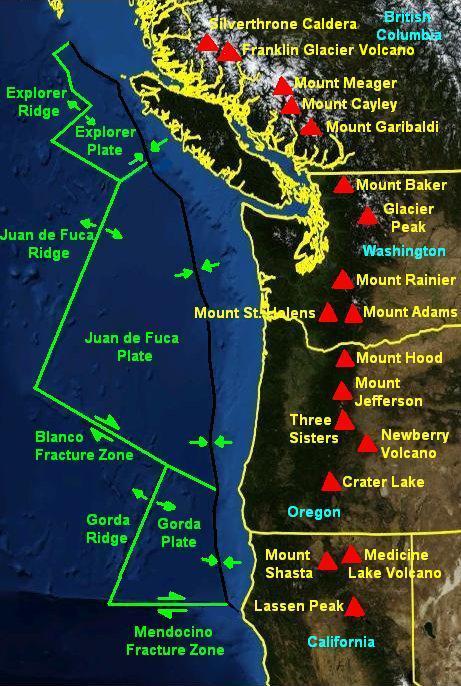
Crater Lake’s history stretches back much further, however. The lake sits atop the Cascade Volcanic Arc, which was created tens of millions of years ago by “subduction,” or the downward movement of one tectonic plate under another–in this case, the Juan de Fuca and Gorda tectonic plates (at right) moving under the North American tectonic plate.
The arc stretches from British Columbia, Canada, south to California. Eighteen major volcanoes, including Mount Mazama, and thousands of smaller volcanic vents dot the arc. Millions of people live throughout the region.
Seven of the volcanoes have had minor eruptions during the past two centuries. The last major eruption came from Mount St. Helens in 1980. According to U.S Geological Survey scientists at the Cascade Volcano Observatory, Mount St. Helens remains highly active and the most likely source of future events along the arc.

Crater Lake in Oregon, in the caldera of Mount Mazama. At 1,943 feet, it is the deepest freshwater lake in the United States. Image by cavalom marinho from Pixabay.
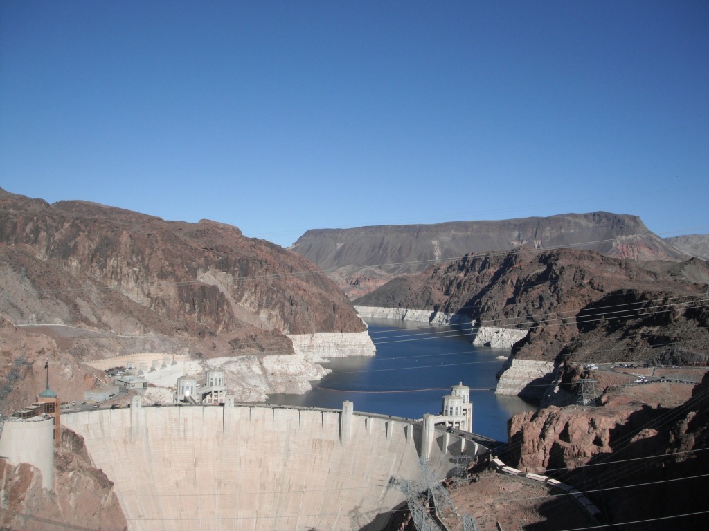
I end with Lake Mead, which I saw a few decades back on a trip to nearby Las Vegas, Nevada. The construction of Hoover Dam on the Colorado River created the lake in 1935. It currently sits at 43% capacity due to persistent drought, higher evaporation, reduced snowmelt runoff, and increased demand from more than 20 million people in Arizona, Nevada, and California.
You’ll notice that a few of these stressors relate to our warming climate. Alas, it seems to leave its mark everywhere, even beyond the lakes.

Works Cited
“Banff National Park (for geology of Lake Louise).” Wikipedia.
“Basics of Lake Science.” North American Lake Management Society.
“Caspian Sea.” Wikipedia.
Chepkemoi, Joyce. “The Largest Reservoirs in the United States.” World Atlas. 30 July 2018.
“Crater Lake.” Wikipedia.
“Glacier Types: Piedmont.” National Snow & Ice Data Center.
Heinze, Bill. “The Mid-Continent Rift Zone.” Michigan State University.
“Lake.” Resource Library. National Geographic.
“Lake Louise.” MountainNature.com.
“Last Glacial Maximum.” Wikipedia.
“Laurentide Ice Sheet.” Wikipedia.
“Meet the New Lake Mead.” National Park Service.
“Midcontinent Rift System.” Wikipedia.
“Mount Mazama Geology.” Wikipedia.
Ray, C. Claiborne Ray. “Was There an Ice Age in the Southern Hemisphere?” The New York Times. 6 June 2016.
Spence, William L. “Building up to the Next Blast.” Moscow (Idaho) Pullman Daily News. 18 May 2020.
Stein, Seth et al. “Using Lake Superior Parks to Explain the Midcontinent Rift.” National Park Service.
“Subduction.” Wikipedia.
“Ten Largest Reservoirs in the United States.” Tata & Howard.
Wilson, Mark. “Wooster geologist at Lake Louise, Banff National Park, Canada.” Wooster Geologists. 10 Aug 2010.
Categories: places

What an excellent idea for a blog!!
LikeLike
Thanks!
LikeLike